- Home
- Symmetry Blog
- How Today's Location Intelligence Platforms Redefine Navigation and Discovery
How Today's Location Intelligence Platforms Redefine Navigation and Discovery

About Jari Haiston
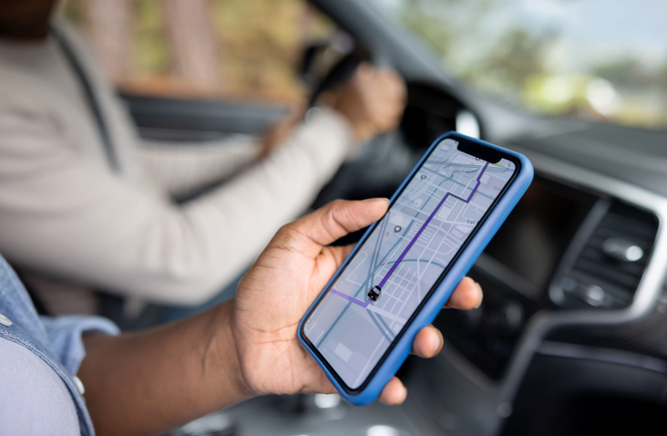
The way we navigate and discover our surroundings has undergone a profound transformation in the past few decades. In fact, it can be argued that everyone nowadays is a modern explorer with advanced location technology so readily available and relied upon. Innovations like the smartphones in our pockets have become indispensable tools, seamlessly integrating location intelligence into our daily lives.
Beyond daily life, the advent of advanced location intelligence technology is also revolutionizing modern exploration. Today’s location intelligence platforms are making Earth’s hidden treasures more accessible than ever before.
The Evolution of Navigation and Discovery
Historically, navigation relied on tools like maps, compasses, and sextants, which, while effective technologies for their time, had their limitations. These methods required manual interpretation, lacked real-time insights, and often resulted in navigational errors due to factors like human error or inaccuracies in available maps.

However, the rise of location-based technological solutions has drastically transcended the constraints of traditional navigation methods, paving the way for more efficient and accurate methods of wayfinding. If only Amelia Earhart and Christopher Columbus could see us now.
What Does Location Intelligence Mean?
Location intelligence refers to the process of deriving meaningful insights from geospatial data to aid decision-making and solve problems. It involves analyzing and visualizing data related to specific geographic locations to understand patterns, trends, and relationships that can inform business strategies, urban planning, disaster response, and more.
More specifically, a location intelligence platform (LIP) is a sophisticated system that leverages the basic principles of tracking with a wide range of technologies to collect, process, analyze, and visualize geospatial data. Some key technologies integrated into LIPs include:
- Geographic Information Systems (GIS): GIS software allows users to capture, store, analyze, and present geographic data on maps. It enables the integration and manipulation of various types of spatial data, such as satellite imagery, aerial photographs, and digital maps.
- Global Positioning System (GPS): GPS technology uses satellite signals to determine the precise location of objects on Earth's surface. It is widely used for navigation, tracking, and asset management applications.
- Remote Sensing: Remote sensing technologies, such as satellite imagery and aerial photography, capture data about the Earth's surface from a distance. This data is used for environmental monitoring, land use planning, agriculture, and disaster assessment.
- Internet of Things (IoT): IoT devices equipped with location-aware sensors collect real-time data about the physical environment. These devices can include smartphones, wearables, vehicle trackers, and environmental sensors, which contribute valuable geospatial information to LIPs.
- Big Data Analytics: Location Intelligence Platforms leverage big data analytics techniques to process and analyze large volumes of geospatial data efficiently. This includes spatial analysis, predictive modeling, clustering, and machine learning algorithms to extract actionable insights from complex datasets.
- Data Visualization: Advanced visualization techniques, such as interactive maps, dashboards, and 3D representations, are used to present geospatial data in a visually intuitive manner. These visualizations help users understand complex spatial relationships and make informed decisions based on the insights gained from the data.
- Geocoding and Address Verification: Geocoding technology translates addresses or place names into geographic coordinates (latitude and longitude), allowing LIPs to accurately plot and analyze data on maps.
Overall, the global location intelligence market size is on the rise. According to Acumen Research and Consulting, the market size accounted for $15.9 billion in 2022 and is expected to reach a significant $66.5 billion by 2032. The growing adoption rate of LIPs can be attributed to how much modern consumer devices rely on the technology.
LIPs play a crucial role in enhancing the functionality and user experience of a wide range of consumer devices and applications in today's interconnected world. Some of the most common applications for LIPs include:
- Smartphones
- Wearables
- In-vehicle Navigation Systems
- Fleet Management Systems
- Asset Tracking Devices
- IoT Devices
- Drones
- Emergency Response Systems
- Augmented Reality Devices (glasses and heads-up displays)
Advanced Navigation Technology Fuels Modern Exploration
While LIPs have found widespread use in conventional applications such as retail optimization and urban planning, their capabilities extend far beyond terrestrial realms.
Undersea Exploration
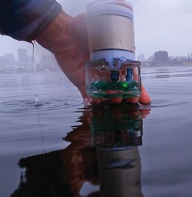
Exploring the depths of our oceans presents unique challenges, including extreme pressures, darkness, and limited visibility. Location intelligence platforms play a crucial role in modern undersea exploration by providing real-time insights and facilitating acoustic signaling for underwater communication.
Battery-Free Navigation
While many professionals and enthusiasts are aware that the industry is shifting towards a battery-less future, fewer might realize that a battery-free future is in the works for navigation technology. One groundbreaking innovation in underwater navigation is the underwater backscatter localization system (UBL), which operates on a net-zero approach by reflecting modulated signals from the environment without emitting its own acoustic signals. This battery-free solution revolutionizes underwater navigation, offering sustainability and efficiency in equal measure.
Positioning Intelligence Innovations Available at Symmetry Electronics Are you a modern-day treasure hunter?
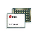
Even if you’re not technically doing the exploring yourself, and you’re more engineering the behind-the-scenes gadgets, Symmetry Electronics has everything you need to design a cutting-edge location intelligence solution. Our line of high precision GNSS (HPG) solutions from u-blox are in stock now and help developers achieve up to centimeter-level accuracy. Their ZED-F9 platform is a game changer in the field s of robotics, unmanned autonomous vehicles (UAVs), and automated machinery. Additionally, u-blox offers a comprehensive line of HPG explorer kits that are all-in-one platforms that streamline evaluation and prototyping to ensure that your team finds the ‘X’ on the map that much sooner.


About Jari Haiston
Subscribe
Stay up to date with industry and supplier news!